Overview
A dual-lens intelligence platform built on Ohio's public Utica Shale oil-and-gas data. One lens is free and landowner-facing — plain-English briefs on the wells and operators under your land. The other is a gated operator lens: offset-well benchmarking, type curves, and permit-activity alerts — an "Enverus-lite" for the Ohio Utica, assembled entirely from open data.
The interesting problem is turning scattered public records into something analysts trust. The platform entity-resolves a well master by API number, joins it to FracFocus completion data and state production spreadsheets, and runs a decline-curve engine on top — the data-science work is the whole point.
Features
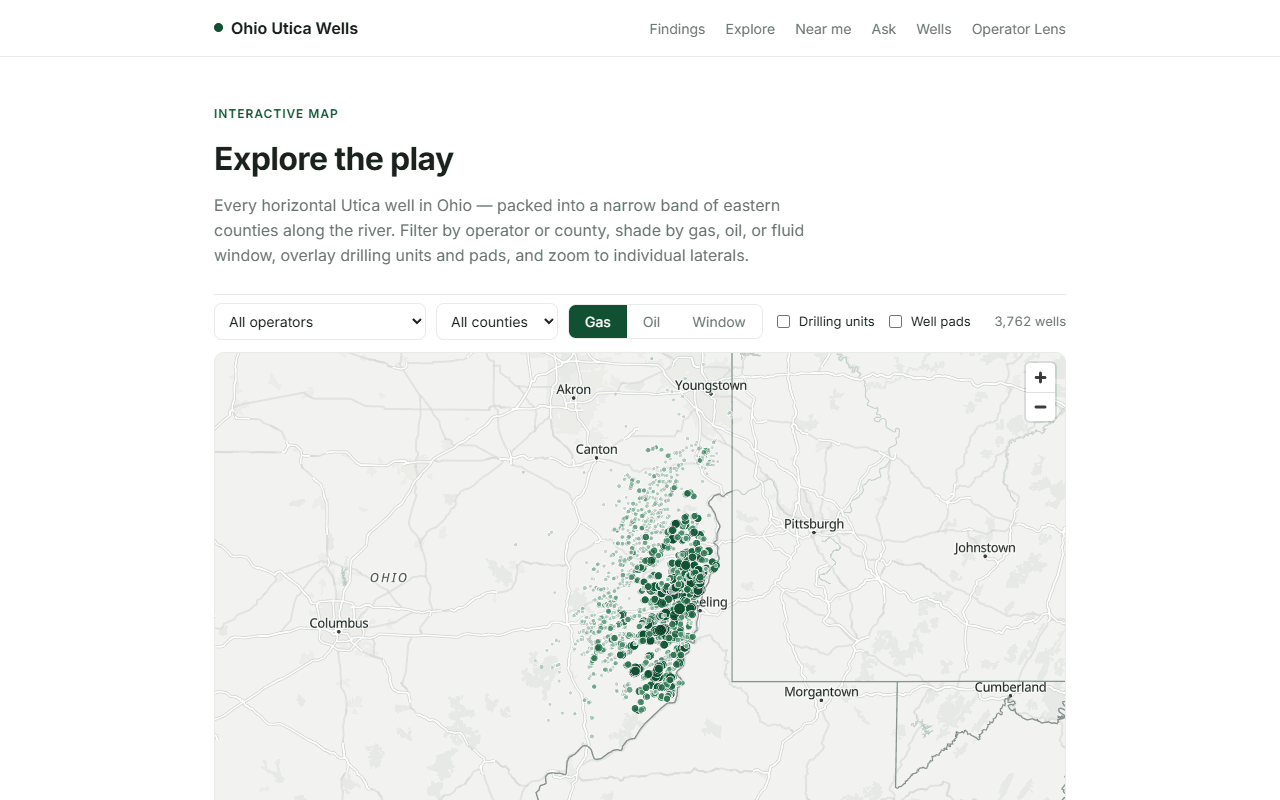
- Open data only — the state ArcGIS well service, the FracFocus bulk completion download, and quarterly production spreadsheets. No scraping, no paid feeds, no auth.
- Lateral length without the PDFs — derived as the great-circle distance between each well's heel and toe coordinates from the public well-head layer, validated against known counties.
- Type curves as the skill proof — decline-curve fitting and offset-well benchmarking are the hard part, and the thing that makes the output credible to an expert audience.
- Numbers are deterministic, prose is not — every figure is computed in SQL or Python. The model writes the English summary only and never touches a number, because one hallucinated production figure is credibility death with this audience.
Stack
Python loaders landing raw public pulls into Postgres, a decline/type-curve engine, and a natural-language query layer over the warehouse, with a Next.js front end. Currently at proof-of-concept stage: data availability confirmed, first loaders working.